National Weather Service says state hit by second derecho of the year
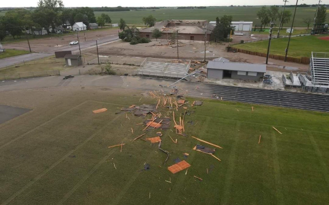
Areas of eastern South Dakota were dealt another blow by Mother Nature on Tuesday, as severe storms rolled across the state throughout the afternoon. The National Weather Service Office in Sioux Falls is calling the widespread thunderstorm complex another derecho, after conferring with the Storms Prediction Center. According to the National Weather Service, the thunderstorm complex meets the terms of a derecho because of the track distance and width criteria, along with sufficient high wind reports. One of the highest wind gusts was reported near Howard and that was 99-miles-per-hour. A 96-mile-per-hour wind gust was also reported near Huron. Both of these communities are dealing with significant damage and clean-up after Tuesday’s storms. Damage was also reported in Salem, Sioux Falls, and other areas of southeastern South Dakota, as well as areas of Nebraska, Minnesota, and Iowa.
July 6, 2022
Related Content

Casey Crabtree Speaks on Summer Studies
DSU Faculty receives Honors

Madison Accident